Cost of Living Support Icon

Using Rights of Way

There are approximately 586km of Public Rights of Way in the Vale of Glamorgan.Their status describes how members of the public may use them.


These are predominantly rural paths and are way marked in the countryside according to their status. 


Footpaths (525km)

Footpath


Bridleways (39km)

Bridleway


Restricted Byways (22km)

Restricted Byway


A few other types of waymark disk may also be encountered. These are usually either

  • White arrows, which indicate that the route is not a formal path but is available by permission of the landowner

  • Brown man on hills, indicating the entry point to open access land

  • Promoted routes, which indicate long distance routes, circular walks or paths that have a leaflet associated with them.


People using wheelchairs or pushchairs are entitled to use all of the above types of path although not all paths will be physically suitable. 

Dog Walking

Dog walking is one of the most popular activities on public rights of way. Whilst dogs are allowed to accompany users there is no requirement for landowners to agree gate or stile alterations to encourage dog walking. It’s therefore wise to check out new routes to ensure they’re suitable before setting out with your pooch.Lady walking dog


Dogs are not required to be on a lead however they should be kept under effective control at all times. Where paths cross fields or other private land dogs should not be allowed to stray from the path, this is especially true around livestock.


Dog faeces can cause serious harm to livestock, agriculture and indeed human health as well as being a nuisance to other path users. Users should always clear up after their dogs and dispose of the waste responsibly. Clear and concise advice can be found relating to the activity in the Dog Walking Code

Definitive Map of Public Rights of WayDefMapLlantwitMajor

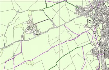
The routes and designations of the paths within our County are shown on The Definitive Map of Public Rights of Way and described in the accompanying Statement. The document has a relevant date of 15th March, 2016 and provides a snapshot of the public rights of way network on that day.


The Map is a legal document and is proof of the existence of a public right of way at that date. Any subsequent changes to the network are made by legal order.


Members of the public may apply for an order to make a change to the Definitive Map, a register of applications may be viewed on this website. A register of landowner declarations regarding rights of way over their land, is also available.


Anyone requiring legal certainty on the location, status or particulars of a public right of way (e.g. for a property conveyance or development scheme) should contact the Council directly or arrange an appointment to inspect the Definitive Map and Statement at the Council’s Docks Offices. 


View Public Rights of Way on Map

Walking Routes and Activities

Information on walks and walking activities can be found on our Visit the Vale website, which includes:

  • Vale Trails - walking routes and accompanying Vale Tales app

  • The Wales Coast Path

  • Valeways who publish information on further circular walks

  • The Millennium Heritage Trail long distance route

Trail-Logos-compilation


Promoted routes are also shown on our interactive mapping.

The Local Access Forum

The Local Access Forum meets four times a year.

The function of the Local Access Forum is to advise the Vale of Glamorgan Council, the Countryside Council for Wales and others as to the improvement of public access to land in the Vale for the purposes of open-air recreation and the enjoyment of the area.


View reports of the Local Access Forum meetings below: